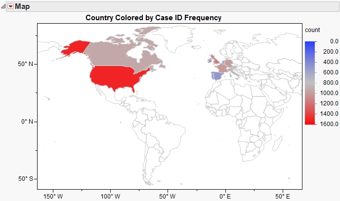
A
geographical map
displays the boundaries of physical entities, landmarks, and other features on a latitude (
y
-axis) and longitude (
x
-axis) scale. Shading (color) denotes some specified data attribute. An example is shown below.