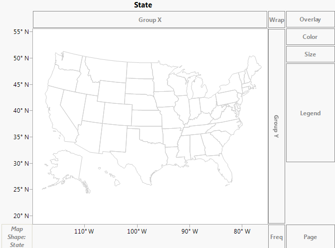
When a column contains the names of geographical regions (such as countries, regions, states, provinces, counties), you can assign the column to the Map Shape zone. When a variable is dropped in Map Shape, Graph Builder looks for map shapes that correspond to the values of the variable and draws the corresponding map. The variable can have a column property that tells JMP where to find the map data. If not, JMP looks through all known map files. If you have a variable in the Map Shape zone, the X and Y zones disappear. The Map Shape zone is positional and influences the types of graph elements that are available.
Example of Cities.jmp After Dragging State to Map Shape
For each map there are two .jmp files; one for the name data (one row per entity) and one for coordinate data (many rows per entity). They are paired via a naming convention; xxx-Name.jmp and xxx-XY.jmp, where "xxx" is some common prefix. Some examples of sample files that are shipped with the product are:
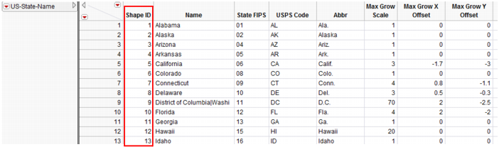
Each xxx-Name.jmp can contain any number of shape name columns, which are identified with a column property. Multiple name columns support localizations and alternate names styles (such as abbreviations), but a given graph usage uses only one column of names. The first column of the Name file must contain unique Shape ID numbers in ascending order.
Example of US-State-Name.jmp
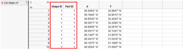
Each xxx-XY.jmp file has four columns. Each row is a coordinate in some shape. Each part is made of one or more shapes. Each shape is a closed polygon. The first column is the same Shape ID as in the xxx-Name file. The second column is the Part ID. The next two columns are X and Y.
Example of US-State-XY.jmp