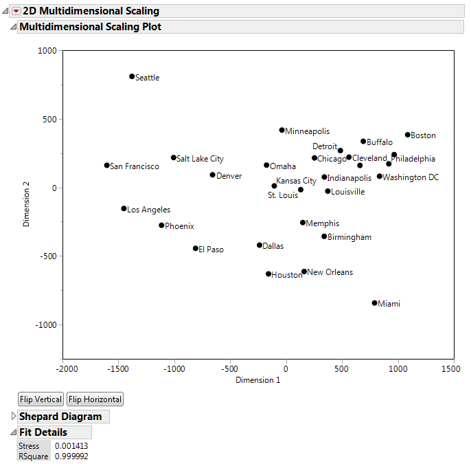
This example uses the Flight Distances.jmp sample data table, which is a distance matrix of flight distances between 28 US cities. You can use MDS to construct a map of the cities in two dimensions that is based on the pairwise distances in the data table.
|
1.
|
|
2.
|
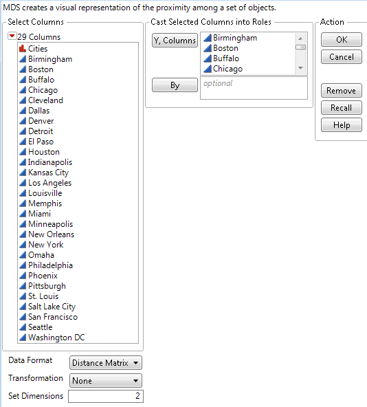
Select Analyze > Multivariate Methods > Multidimensional Scaling.
|
|
3.
|
|
4.
|
Click OK.
|
|
5.
|
Select the Flight Distances data table.
|
|
6.
|
|
7.
|
Select Rows > Row Selection> Select all Rows.
|
|
8.
|
Select Rows > Lable/Unlabel.
|
|
10.
|
Click on the Flip Vertical button.
|
|
11.
|
Click on the Flip Horizontal button.
|
Figure 8.3 Multidimensional Scaling Plot