|
1.
|
|
2.
|
Select Graph > Graph Builder.
|
|
3.
|
Drag the Latitude column to the Y axis.
|
|
4.
|
Drag the Longitude column to the X axis.
|
|
5.
|
Right-click the graph and select Graph > Background Map.
|
|
6.
|
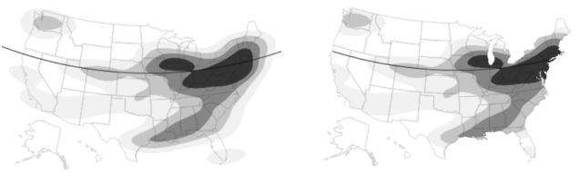
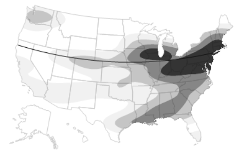
Figure 15.40 Background Map
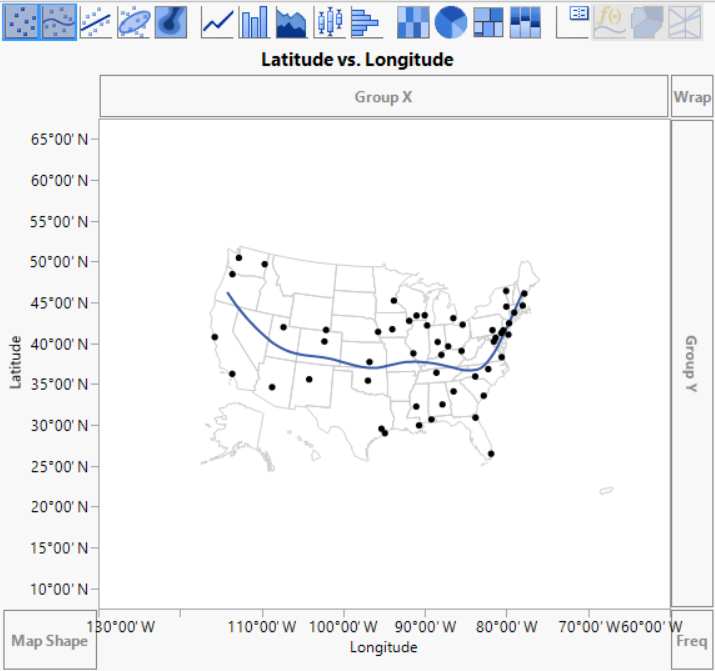
Figure 15.41 Unclipped Contours on Background Map
|
1.
|
On the Latitude axis, double-click 45°00’ N to open the Y Axis Settings window.
|
|
3.
|
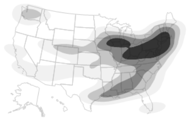
Figure 15.42 Unclipped Reference Line
|
1.
|
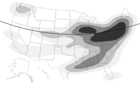
Right-click the graph and select Customize.
|
|
2.
|
|
3.
|
Figure 15.43 Clipped Reference Line and Contours
|
•
|
The boundaries that appear in the Background Map window are installed in the JMP Maps installation folder. See Custom Map Files for details about adding your own boundaries.
|